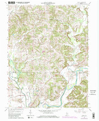
1966 Map of Arney
USGS Topo · Published 1981About this map
The White River and Eel River converge at the southern edge of this map, shaping a landscape of fertile bottomlands and high ridges between Owen and Greene Counties. The historic site of Point Commerce sits near this confluence, a location once vital to early river-based trade before the rise of the railroads. Moving north, the terrain becomes increasingly dissected by numerous waterways including Fish Creek, Beech Creek, and Brush Creek, which carve through prominent elevations such as Dillon Hill and Need Hill.
Find a feature on this map
36 named features on this map. Tap any name to fly to it.
Don’t see what you’re looking for? This feature index may not catch every label — zoom into the map to look around manually.
Map Details
Editions of this 1966 Arney Map
Other maps of this area

1908 · Clay City
USGS Topo · 1:48,000

1908 · Bloomfield
USGS Topo · 1:62,500

1910 · Clay City
USGS Topo · 1:62,500

1938 · Coal City
USGS Topo · 1:24,000

1938 · Switz City
USGS Topo · 1:24,000

1947 · Switz City
USGS Topo · 1:24,000

1948 · Coal City
USGS Topo · 1:24,000

1950 · Arney
USGS Topo · 1:24,000

1950 · Switz City
USGS Topo · 1:24,000

1951 · Bloomfield
USGS Topo · 1:24,000