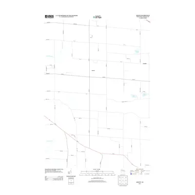
2013 Map of Arnott
USGS Topo · Published 2013About this map
Arnott serves as the central point of this agricultural and woodland landscape in Portage County, where a grid of rural roads connects small settlements and local water bodies. To the east, the community of Fancher sits near the intersection of Co Hwy-B and Smokey Rd, while the northern reaches are defined by the winding course of the Little Plover River. The geography is characterized by several small glacial lakes, including Thomas Lake, Bear Lake, and Adams Lake, which provide natural breaks in the rectangular field patterns. Drainage across the western edge is managed by the Isherwood Lateral, a man-made waterway that reflects the region's managed hydrology. The map illustrates a contemporary rural Wisconsin environment where traditional county highways like Co Hwy-J facilitate movement between family farms and woodlots.
Find a feature on this map
48 named features on this map. Tap any name to fly to it.
Don’t see what you’re looking for? This feature index may not catch every label — zoom into the map to look around manually.
Map Details
Editions of this 2013 Arnott Map
This is the sole edition of this map. No revisions or reprints were ever made.
Other maps of this area

1955 · Rosholt
USGS Topo · 1:48,000

1955 · Green Bay
USGS Topo · 1:250,000

1956 · Stevens Point
USGS Topo · 1:48,000

1957 · Amherst
USGS Topo · 1:48,000

1957 · Whiting
USGS Topo · 1:48,000
1969 · Blaine
USGS Topo · 1:24,000

1969 · New Hope
USGS Topo · 1:24,000

1969 · Arnott
USGS Topo · 1:24,000
1969 · Almond
USGS Topo · 1:24,000
1969 · Polonia
USGS Topo · 1:24,000