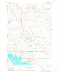
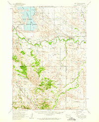
1965 Map of Arpan
USGS Topo · Published 1967About this map
Belle Fourche Reservoir dominates the southern landscape of this Butte County region, where the high plains meet managed irrigation. The mid-1960s terrain shows a complex network of water management, including the North Canal, Young Lateral, and Lafemme Lateral, which redirect the flow from natural drainages like Indian Creek and Bitter Creek. These man-made features highlight the transition of the South Dakota prairie into a productive agricultural zone.
Find a feature on this map
16 named features on this map. Tap any name to fly to it.
Don’t see what you’re looking for? This feature index may not catch every label — zoom into the map to look around manually.
Map Details
Editions of this 1965 Arpan Map
This is the sole edition of this map. No revisions or reprints were ever made.
Other maps of this area

1905 · Saint Onge
USGS Topo · 1:62,500

1905 · Indian
USGS Topo · 1:62,500

1906 · Two Top
USGS Topo · 1:62,500

1907 · Belle Fourche
USGS Topo · 1:125,000

1907 · Redwater
USGS Topo · 1:62,500
1951 · Nisland
USGS Topo · 1:24,000

1953 · Rapid City
USGS Topo · 1:250,000
1954 · Belle Fourche
USGS Topo · 1:24,000
1954 · Fruitdale
USGS Topo · 1:24,000
1954 · Saint Onge
USGS Topo · 1:62,500