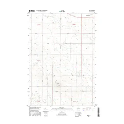
2015 Map of Arpin
USGS Topo · Published 2015About this map
Arpin and Auburndale anchor this central Wisconsin landscape, which is defined by a dense network of country roads and local drainage systems. The terrain is characterized by the meandering courses of Mill Creek in the north and several branches of Hemlock Creek to the south. This area in Wood County shows a high concentration of small, family-named or local cemeteries, such as Indian Bill Cemetery and John Ne- Wee Cemetery, suggesting a deeply rooted rural community with long-standing family ties. Small settlements like Bethel serve as localized hubs within a grid of agricultural tracts, connected by a network of named routes including Richfield Drive and Bluff Drive. The map reflects a stable rural infrastructure where the land is divided clearly into townships like T24N R4E, maintaining a layout established long before the 21st century.
Find a feature on this map
42 named features on this map. Tap any name to fly to it.
Don’t see what you’re looking for? This feature index may not catch every label — zoom into the map to look around manually.
Map Details
Editions of this 2015 Arpin Map
This is the sole edition of this map. No revisions or reprints were ever made.
Other maps of this area

1953 · Eau Claire
USGS Topo · 1:250,000

1954 · Marshfield
USGS Topo · 1:62,500

1955 · Green Bay
USGS Topo · 1:250,000

1956 · Milladore
USGS Topo · 1:48,000

1957 · Wisconsin Rapids
USGS Topo · 1:48,000

1957 · Pittsville
USGS Topo · 1:48,000

1958 · Eau Claire
USGS Topo · 1:250,000

1964 · Eau Claire
USGS Topo · 1:250,000

1967 · Wisconsin Rapids
USGS Topo · 1:62,500

1967 · Pittsville
USGS Topo · 1:62,500