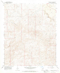
1967 Map of Arrastra Mtn
USGS Topo · Published 1969About this map
Poachie Range and Arrastra Mountain dominate this corner of Mohave County, where the desert landscape is defined by its vital water sources and early mining endeavors. A network of Jeep Trails threads through the high ground, connecting remote landmarks like Black Canyon Spring, Colorado Spring, and Poachie Spring. These reliable seeps were critical for both wildlife and the prospectors who scoured these slopes for mineral wealth.
Find a feature on this map
11 named features on this map. Tap any name to fly to it.
Don’t see what you’re looking for? This feature index may not catch every label — zoom into the map to look around manually.
Map Details
Editions of this 1967 Arrastra Mtn Map
2 editions found
Other maps of this area

1923 · Signal
USGS Topo · 1:250,000

1942 · Signal
USGS Topo · 1:250,000

1950 · Prescott
USGS Topo · 1:250,000

1954 · Prescott
USGS Topo · 1:250,000

1958 · Prescott
USGS Topo · 1:250,000

1959 · Prescott
USGS Topo · 1:250,000

1960 · Prescott
USGS Topo · 1:250,000

1965 · Prescott
USGS Topo · 1:250,000

1966 · Artillery Peak
USGS Topo · 1:62,500
1967 · Arrastra Mtn SE
USGS Topo · 1:24,000