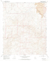
1967 Map of Arrastra Mtn
USGS Topo · Published 1982About this map
The Poachie Range and Arrastra Mountain dominate this mid-century desert landscape in Mohave County. This 1967 field-checked survey reveals a remote high-desert environment defined by sparse water sources and early mining activity. Vital water points such as Poachie Spring, Colorado Spring, and Snake Spring are scattered throughout the elevations, providing essential resources in an otherwise arid terrain. Evidence of mineral exploration is visible through several labels, including the Antler Mine in the southern reaches and multiple Prospect sites. A network of Jeep Trails provides the primary means of traversal through the mountainous gaps, connecting the low-lying Government Wash with higher ridgelines. The presence of a Well and various springs suggests the persistent human effort to secure water in this part of Arizona during the late 1960s.
Find a feature on this map
15 named features on this map. Tap any name to fly to it.
Don’t see what you’re looking for? This feature index may not catch every label — zoom into the map to look around manually.
Map Details
Editions of this 1967 Arrastra Mtn Map
2 editions found
Other maps of this area

1923 · Signal
USGS Topo · 1:250,000

1942 · Signal
USGS Topo · 1:250,000

1950 · Prescott
USGS Topo · 1:250,000

1954 · Prescott
USGS Topo · 1:250,000

1958 · Prescott
USGS Topo · 1:250,000

1959 · Prescott
USGS Topo · 1:250,000

1960 · Prescott
USGS Topo · 1:250,000

1965 · Prescott
USGS Topo · 1:250,000

1966 · Artillery Peak
USGS Topo · 1:62,500
1967 · Arrastra Mtn SE
USGS Topo · 1:24,000