2013 Map of Arriba
USGS Topo · Published 2013About this map
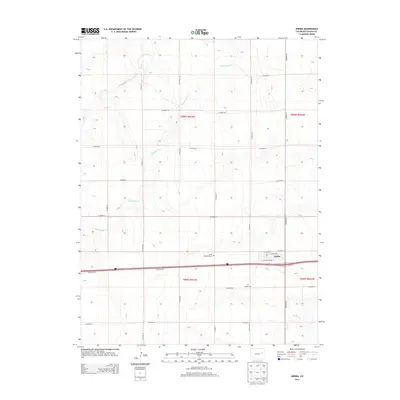
The town of Arriba sits as a central hub on the High Plains of eastern Colorado, defined by a grid of streets including Rock Island Ave and Lincoln Ave. This landscape is marked by the intermittent drainage patterns of the region, where Hell Creek and Hackberry Cr carve subtle coulees through the prairie. Just outside the main settlement, the Arriba Evergreen Cem and Arriba Cem serve as significant landmarks for those researching local family histories. The surrounding area is strictly organized by the Public Land Survey System, with an extensive network of rural routes such as Co Road 39 and Co Road 40 providing access to the agricultural sections. In the southeastern portion, Buffalo Cr crosses the plains, illustrating the typical hydrology of Lincoln County's open ranching and farming country.
Find a feature on this map
30 named features on this map. Tap any name to fly to it.
Don’t see what you’re looking for? This feature index may not catch every label — zoom into the map to look around manually.
Map Details
Editions of this 2013 Arriba Map
This is the sole edition of this map. No revisions or reprints were ever made.
Other maps of this area

1954 · Limon
USGS Topo · 1:250,000

1957 · Limon
USGS Topo · 1:250,000

1958 · Limon
USGS Topo · 1:250,000

1978 · Hugo 4 NW
USGS Topo · 1:24,000

1979 · Arriba NW
USGS Topo · 1:24,000

1979 · Sevenmile Ranch
USGS Topo · 1:24,000

1979 · Arriba
USGS Topo · 1:24,000

1979 · Flagler SW
USGS Topo · 1:24,000

1979 · Genoa East
USGS Topo · 1:24,000

1979 · Flagler NW
USGS Topo · 1:24,000