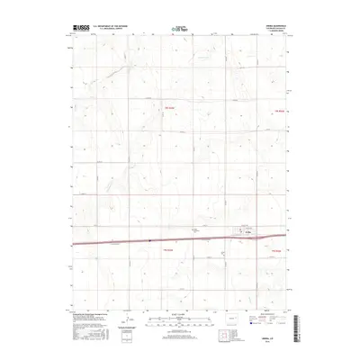
2016 Map of Arriba
USGS Topo · Published 2016About this map
Arriba serves as the primary hub of this High Plains landscape, situated along a vital east-west corridor during the mid-2010s. The town's grid is anchored by College Ave and Lincoln Ave, with the community's history preserved at the Arriba Evergreen Cem and the Arriba Cem located just to the south. The surrounding terrain is defined by the ephemeral drainage patterns of the eastern plains, where watercourses like Hell Creek, Hackberry Cr, and Buffalo Cr carve subtle impressions across the township and range lines of t8s r53w and t9s r53w. A dense network of county roads, including Co RD 39 and Co RD 42, illustrates the late-twentieth-century section-line grid that supports the region's agricultural character.
Find a feature on this map
28 named features on this map. Tap any name to fly to it.
Don’t see what you’re looking for? This feature index may not catch every label — zoom into the map to look around manually.
Map Details
Editions of this 2016 Arriba Map
This is the sole edition of this map. No revisions or reprints were ever made.
Other maps of this area

1954 · Limon
USGS Topo · 1:250,000

1957 · Limon
USGS Topo · 1:250,000

1958 · Limon
USGS Topo · 1:250,000

1978 · Hugo 4 NW
USGS Topo · 1:24,000

1979 · Arriba NW
USGS Topo · 1:24,000

1979 · Sevenmile Ranch
USGS Topo · 1:24,000

1979 · Arriba
USGS Topo · 1:24,000

1979 · Flagler SW
USGS Topo · 1:24,000

1979 · Genoa East
USGS Topo · 1:24,000

1979 · Flagler NW
USGS Topo · 1:24,000