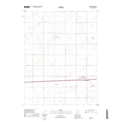
2019 Map of Arriba
USGS Topo · Published 2019About this map
Arriba serves as the central hub of this High Plains landscape, where the local road network converges around a core of residential streets including College Ave and Lincoln Ave. The town is flanked by its resting places, the Arriba-Evergreen Cem to the north and the Arriba Cem to the south, providing clear points of interest for genealogical research. The surrounding terrain is defined by the intermittent drainage of the plains, with seasonal waterways like Hell Creek and Hackberry Cr carving subtle paths through the township. The infrastructure is primarily agricultural and transit-oriented, following a strict section-line grid that governs the movement across t8s r53w and neighboring tracts.
Find a feature on this map
29 named features on this map. Tap any name to fly to it.
Don’t see what you’re looking for? This feature index may not catch every label — zoom into the map to look around manually.
Map Details
Editions of this 2019 Arriba Map
This is the sole edition of this map. No revisions or reprints were ever made.
Other maps of this area

1954 · Limon
USGS Topo · 1:250,000

1957 · Limon
USGS Topo · 1:250,000

1958 · Limon
USGS Topo · 1:250,000

1978 · Hugo 4 NW
USGS Topo · 1:24,000

1979 · Arriba NW
USGS Topo · 1:24,000

1979 · Sevenmile Ranch
USGS Topo · 1:24,000

1979 · Arriba
USGS Topo · 1:24,000

1979 · Flagler SW
USGS Topo · 1:24,000

1979 · Genoa East
USGS Topo · 1:24,000

1979 · Flagler NW
USGS Topo · 1:24,000