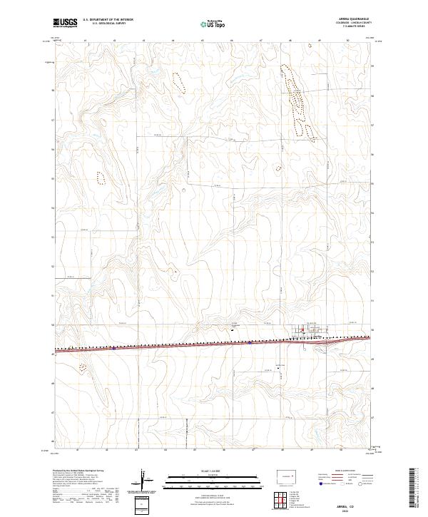
2022 Map of Arriba
USGS Topo · Published 2022About this map
Arriba sits at the intersection of local routes and modern infrastructure in this Lincoln County landscape. The settlement is defined by a grid of streets including College Ave and Lincoln Ave, positioned just north of the Interstate 70 corridor. Local heritage is preserved at two distinct sites: the Arriba-Evergreen Cem and the Arriba Cem, both serving as essential points of reference for genealogical research in the area. The surrounding plains are etched by intermittent drainage systems, notably Hell Creek and its tributaries such as Hackberry Cr, which wind through the township sections. This 2022 survey illustrates the enduring relationship between the high plains drainage patterns and the established road network, which follows the rigid section lines of the Public Land Survey System including Co RD 3h and Co HWY 63.
Find a feature on this map
29 named features on this map. Tap any name to fly to it.
Don’t see what you’re looking for? This feature index may not catch every label — zoom into the map to look around manually.
Map Details
Editions of this 2022 Arriba Map
This is the sole edition of this map. No revisions or reprints were ever made.
Other maps of this area

1954 · Limon
USGS Topo · 1:250,000

1957 · Limon
USGS Topo · 1:250,000

1958 · Limon
USGS Topo · 1:250,000

1978 · Hugo 4 NW
USGS Topo · 1:24,000

1979 · Arriba NW
USGS Topo · 1:24,000

1979 · Sevenmile Ranch
USGS Topo · 1:24,000

1979 · Arriba
USGS Topo · 1:24,000

1979 · Flagler SW
USGS Topo · 1:24,000

1979 · Genoa East
USGS Topo · 1:24,000

1979 · Flagler NW
USGS Topo · 1:24,000