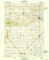
1952 Map of Arrowsmith
USGS Topo · Published 1953About this map
The Sangamon River meanders through the central Illinois prairie, anchoring a landscape defined by the parallel growth of agriculture and the railroad. In the early 1950s, the region was a dense network of small rail towns and grain stops, with the New York Chicago and St Louis and the Illinois Central lines connecting settlements like Saybrook, Arrowsmith, and Bellflower. This survey captures the rural social fabric of the era, documented through numerous country cemeteries such as Frankeberger Cem and Greenwood Cem, and local institutions like the Prairie Chapel and Le Roy Sch. The map reveals a transition from traditional land-surveyed townships to a modern transportation corridor, particularly evident where the Illinois Central cuts through the southern reaches near Farmer City and Weedman.
Find a feature on this map
49 named features on this map. Tap any name to fly to it.
Don’t see what you’re looking for? This feature index may not catch every label — zoom into the map to look around manually.
Map Details
Editions of this 1952 Arrowsmith Map
2 editions found
Other maps of this area

1907 · Mahomet
USGS Topo · 1:62,500

1926 · Normal
USGS Topo · 1:62,500

1928 · Gibson City
USGS Topo · 1:62,500

1930 · Normal
USGS Topo · 1:62,500

1937 · Monticello
USGS Topo · 1:48,000

1943 · Monticello
USGS Topo · 1:62,500

1947 · Sibley
USGS Topo · 1:62,500

1949 · Sibley
USGS Topo · 1:62,500

1951 · Le Roy
USGS Topo · 1:62,500

1952 · Arrowsmith
USGS Topo · 1:62,500