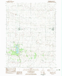
1983 Map of Arrowsmith
USGS Topo · Published 1983About this map
Ellsworth and Arrowsmith anchor this portion of McLean County, where the agricultural prairie is bisected by the Norfolk and Western railroad. The landscape is defined by its glacial heritage, notably the terminal moraine preserved within Moraine View State Park. This park surrounds Dawson Lake and provides a stark contrast to the surrounding grid of section lines and township boundaries like Dawson and Arrowsmith. Genealogists will find several rural burial grounds scattered across the townships, including Payne Cem and Frankeberger Cem. The headwaters of the Sangamon River and Salt Creek drain the undulating terrain, winding through a patchwork of farms marked by grain tanks and local landmarks like Blue Mound.
Find a feature on this map
25 named features on this map. Tap any name to fly to it.
Don’t see what you’re looking for? This feature index may not catch every label — zoom into the map to look around manually.
Map Details
Editions of this 1983 Arrowsmith Map
This is the sole edition of this map. No revisions or reprints were ever made.
Other maps of this area

1926 · Normal
USGS Topo · 1:62,500

1930 · Normal
USGS Topo · 1:62,500

1951 · Le Roy
USGS Topo · 1:62,500

1952 · Arrowsmith
USGS Topo · 1:62,500

1957 · Colfax
USGS Topo · 1:62,500

1958 · Peoria
USGS Topo · 1:250,000

1961 · Peoria
USGS Topo · 1:250,000

1963 · Peoria
USGS Topo · 1:250,000
1981 · Holder
USGS Topo · 1:24,000
1981 · Merna
USGS Topo · 1:24,000