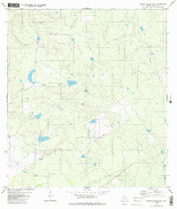
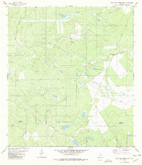
1980 Map of Arroyo Salado East
USGS Topo · Published 1980About this map
Arroyo Salado defines the drainage of this Zapata County landscape during the mid-1970s, carving a winding path through the brushy South Texas terrain. The map captures a moment when traditional ranching environments were increasingly dotted with petroleum infrastructure, evidenced by the presence of a Gas Well in the southeastern quadrant. Small stock tanks and unnamed water features scattered across the contours suggest a rural economy heavily dependent on seasonal water management. Along with Cavaso Creek, these seasonal waterways dictate the natural movement across the land, highlighting the sparse and functional character of this borderlands region before further modern development.
Find a feature on this map
3 named features on this map. Tap any name to fly to it.
Don’t see what you’re looking for? This feature index may not catch every label — zoom into the map to look around manually.
Map Details
Editions of this 1980 Arroyo Salado East Map
2 editions found
Other maps of this area

1933 · Becerra Creek
USGS Topo · 1:62,500

1940 · Aguilares
USGS Topo · 1:62,500

1940 · Mogotes Hill
USGS Topo · 1:62,500

1942 · San Ygnacio
USGS Topo · 1:62,500

1956 · Mogotes Hill
USGS Topo · 1:62,500

1956 · Laredo
USGS Topo · 1:250,000
1979 · San Ygnacio
USGS Topo · 1:24,000

1979 · O'Keefe Lake
USGS Topo · 1:24,000
1980 · Mogotes Hill
USGS Topo · 1:24,000
1980 · Agua Azul Creek West
USGS Topo · 1:24,000