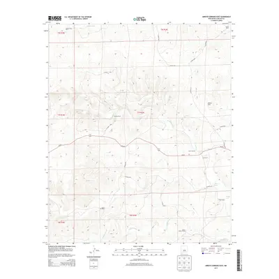
2013 Map of Arroyo Serrano East
USGS Topo · Published 2013About this map
Paecheco Ranch and Corns Ranch represent the enduring ranching character of this Lincoln County landscape, where water management remains critical to livestock operations. The terrain is defined by a network of seasonal drainages, including Arroyo Serrano, Middle Arroyo, and Zeufeldt Arroyo, which cut through the high desert. Man-made infrastructure like Millers Windmill and Winkler Middle Windmill highlights the reliance on groundwater in an area where surface water is ephemeral. The survey also captures the transition between the Lowrey Ranch and Lowrey Sheep Camp to the north, connected by a network of local roads such as NM-246 and Co Road b020. These cattle and sheep operations, alongside Russell Bird Ranch and Winkler Ranch, illustrate the dispersed settlement pattern typical of the New Mexico interior.
Find a feature on this map
26 named features on this map. Tap any name to fly to it.
Don’t see what you’re looking for? This feature index may not catch every label — zoom into the map to look around manually.
Map Details
Editions of this 2013 Arroyo Serrano East Map
This is the sole edition of this map. No revisions or reprints were ever made.
Other maps of this area

1936 · Arabela
USGS Topo · 1:48,000

1942 · Arabela
USGS Topo · 1:62,500

1955 · Roswell
USGS Topo · 1:250,000

1958 · Roswell
USGS Topo · 1:250,000

1962 · Roswell
USGS Topo · 1:250,000

1967 · North Lake
USGS Topo · 1:24,000

1967 · White Flat
USGS Topo · 1:24,000
1967 · Elsie Canyon
USGS Topo · 1:24,000
1979 · Salt Creek
USGS Topo · 1:100,000

1981 · Huff Hill
USGS Topo · 1:24,000