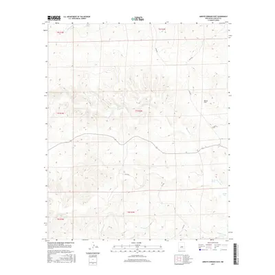
2017 Map of Arroyo Serrano East
USGS Topo · Published 2017About this map
Arroyo Serrano and its associated drainage systems define the high desert topography of this eastern Lincoln County landscape. The area is characterized by a network of seasonal watercourses, including the Middle Arroyo and Arroyo Seco, which carve through the arid terrain. The land is systematically organized by the Public Land Survey System, with boundaries such as t7s r19e and t8s r19e marking the transition between townships. Human presence is indicated primarily by a sparse network of county infrastructure, such as Co Rd B020 and Co Rd B031, which navigate the contours of the land. Further south, Zeufeldt Arroyo runs through the lower reaches of the quadrangle, illustrating the natural watershed patterns of the New Mexico interior.
Find a feature on this map
16 named features on this map. Tap any name to fly to it.
Don’t see what you’re looking for? This feature index may not catch every label — zoom into the map to look around manually.
Map Details
Editions of this 2017 Arroyo Serrano East Map
This is the sole edition of this map. No revisions or reprints were ever made.
Other maps of this area

1936 · Arabela
USGS Topo · 1:48,000

1942 · Arabela
USGS Topo · 1:62,500

1955 · Roswell
USGS Topo · 1:250,000

1958 · Roswell
USGS Topo · 1:250,000

1962 · Roswell
USGS Topo · 1:250,000

1967 · North Lake
USGS Topo · 1:24,000

1967 · White Flat
USGS Topo · 1:24,000
1967 · Elsie Canyon
USGS Topo · 1:24,000
1979 · Salt Creek
USGS Topo · 1:100,000

1981 · Huff Hill
USGS Topo · 1:24,000