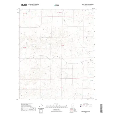
2020 Map of Arroyo Serrano East
USGS Topo · Published 2020About this map
Arroyo systems define the drainage patterns across this Lincoln County landscape, showing the transition of seasonal waterways through the high desert. The namesake Arroyo Serrano travels through the eastern reaches, joined by other significant channels like Arroyo Seco and the winding Middle Arroyo in the northwest. These drainage features, along with Walnut Draw, highlight the natural topography that dictated early land use and movement in the region.
Find a feature on this map
15 named features on this map. Tap any name to fly to it.
Don’t see what you’re looking for? This feature index may not catch every label — zoom into the map to look around manually.
Map Details
Editions of this 2020 Arroyo Serrano East Map
This is the sole edition of this map. No revisions or reprints were ever made.
Other maps of this area

1936 · Arabela
USGS Topo · 1:48,000

1942 · Arabela
USGS Topo · 1:62,500

1955 · Roswell
USGS Topo · 1:250,000

1958 · Roswell
USGS Topo · 1:250,000

1962 · Roswell
USGS Topo · 1:250,000

1967 · North Lake
USGS Topo · 1:24,000

1967 · White Flat
USGS Topo · 1:24,000
1967 · Elsie Canyon
USGS Topo · 1:24,000
1979 · Salt Creek
USGS Topo · 1:100,000

1981 · Huff Hill
USGS Topo · 1:24,000