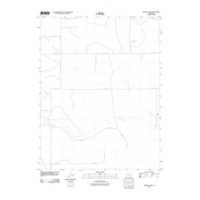
2010 Map of Arsenic Lake
USGS Topo · Published 2010About this map
Arsenic Lake and the meandering path of Rush Creek define this section of the High Plains in Cheyenne County, Colorado. The landscape is organized by a strict cardinal grid of rural routes, including County Road B at the southern edge and County Road L at the northern boundary. These long straightaways are interrupted only by the natural contours of the creek bed and the occasional clustered buildings of local operations like the Larson Ranch.
Find a feature on this map
16 named features on this map. Tap any name to fly to it.
Don’t see what you’re looking for? This feature index may not catch every label — zoom into the map to look around manually.
Map Details
Editions of this 2010 Arsenic Lake Map
This is the sole edition of this map. No revisions or reprints were ever made.
Other maps of this area

1891 · Arroyo
USGS Topo · 1:125,000

1891 · Kit Carson
USGS Topo · 1:125,000

1893 · Arroyo
USGS Topo · 1:125,000

1893 · Kit Carson
USGS Topo · 1:125,000

1954 · Lamar
USGS Topo · 1:250,000

1958 · Lamar
USGS Topo · 1:250,000

1978 · Galatea NE
USGS Topo · 1:24,000
1978 · Wild Horse
USGS Topo · 1:24,000
1978 · Galatea
USGS Topo · 1:24,000

1981 · Cheyenne Wells
USGS Topo · 1:100,000