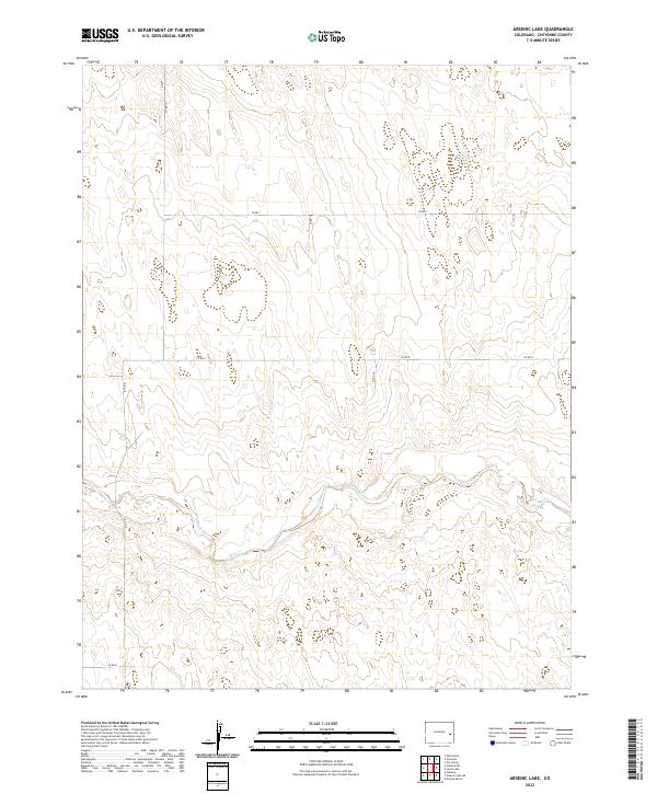
2022 Map of Arsenic Lake
USGS Topo · Published 2022About this map
Arsenic Lake sits in the high plains of Cheyenne County, Colorado, serving as the namesake for this landscape defined by its open terrain and ephemeral watercourses. The drainage of Rush Creek and its tributary Rush Cr meanders across the southern half of the map, carving subtle contours through the prairie. This 2022 survey illustrates the enduring township and range system, with section lines and grazing land partitioned by a network of county routes including Co Rd 10, Co Rd J, and Co Rd G. The rural infrastructure is comprised almost entirely of these unpaved roads, which facilitate access between remote ranches and the cattle-raising operations of the Eastern Plains. The absence of concentrated settlements highlights the vast, agricultural character of the region, where life is dictated by the proximity to water sources and the grid of the county road system.
Find a feature on this map
13 named features on this map. Tap any name to fly to it.
Don’t see what you’re looking for? This feature index may not catch every label — zoom into the map to look around manually.
Map Details
Editions of this 2022 Arsenic Lake Map
This is the sole edition of this map. No revisions or reprints were ever made.
Other maps of this area

1891 · Arroyo
USGS Topo · 1:125,000

1891 · Kit Carson
USGS Topo · 1:125,000

1893 · Arroyo
USGS Topo · 1:125,000

1893 · Kit Carson
USGS Topo · 1:125,000

1954 · Lamar
USGS Topo · 1:250,000

1958 · Lamar
USGS Topo · 1:250,000

1978 · Galatea NE
USGS Topo · 1:24,000
1978 · Wild Horse
USGS Topo · 1:24,000
1978 · Galatea
USGS Topo · 1:24,000

1981 · Cheyenne Wells
USGS Topo · 1:100,000