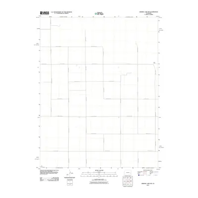
2010 Map of Arsenic Lake SW
USGS Topo · Published 2010About this map
Salle Ranch stands as a primary named landmark in this expanse of Cheyenne County, where the landscape is defined by an orderly grid of rural transport. The map reveals the meticulous surveying of the High Plains, with east-west arteries like County Road AA, County Road Z, and County Road U intersecting a series of north-south routes. This pattern of land division reflects the agricultural organization of the early 21st century, facilitating movement across open terrain. While the area is sparsely settled, the presence of specific family-named sites like the ranch provides a localized anchor for genealogists and researchers tracking land use and ownership in this part of eastern Colorado.
Find a feature on this map
16 named features on this map. Tap any name to fly to it.
Don’t see what you’re looking for? This feature index may not catch every label — zoom into the map to look around manually.
Map Details
Editions of this 2010 Arsenic Lake SW Map
This is the sole edition of this map. No revisions or reprints were ever made.
Other maps of this area

1891 · Arroyo
USGS Topo · 1:125,000

1891 · Kit Carson
USGS Topo · 1:125,000

1891 · Las Animas
USGS Topo · 1:125,000

1892 · Lamar
USGS Topo · 1:125,000

1893 · Arroyo
USGS Topo · 1:125,000

1893 · Kit Carson
USGS Topo · 1:125,000

1893 · Las Animas
USGS Topo · 1:125,000

1954 · Lamar
USGS Topo · 1:250,000

1958 · Lamar
USGS Topo · 1:250,000

1968 · Hawkins
USGS Topo · 1:24,000