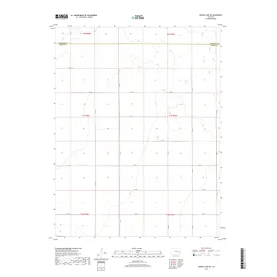
2019 Map of Arsenic Lake SW
USGS Topo · Published 2019About this map
The Cheyenne Co Kiowa Co boundary line bisects this high plains landscape, defining the administrative divide in a region characterized by its expansive grid of section lines and rural infrastructure. The terrain is marked by subtle topographic variations, captured through precise contouring that reveals the drainage patterns and depressions of this arid environment. A systematic network of county roads, including north-south corridors like Co Rd 31 and Co Rd 35, provide the primary framework for land access across multiple townships, such as t17s r50w and t18s r49w. The organization of these roads, from Co Rd AA in the north to Co Rd U in the south, reflects the enduring Public Land Survey System that shaped the settlement and agricultural development of eastern Colorado. This map serves as a clear record of land division and transportation at the edge of the High Plains.
Find a feature on this map
20 named features on this map. Tap any name to fly to it.
Don’t see what you’re looking for? This feature index may not catch every label — zoom into the map to look around manually.
Map Details
Editions of this 2019 Arsenic Lake SW Map
This is the sole edition of this map. No revisions or reprints were ever made.
Other maps of this area

1891 · Arroyo
USGS Topo · 1:125,000

1891 · Kit Carson
USGS Topo · 1:125,000

1891 · Las Animas
USGS Topo · 1:125,000

1892 · Lamar
USGS Topo · 1:125,000

1893 · Arroyo
USGS Topo · 1:125,000

1893 · Kit Carson
USGS Topo · 1:125,000

1893 · Las Animas
USGS Topo · 1:125,000

1954 · Lamar
USGS Topo · 1:250,000

1958 · Lamar
USGS Topo · 1:250,000

1968 · Hawkins
USGS Topo · 1:24,000