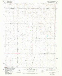
1982 Map of Arsenic Lake SW
USGS Topo · Published 1982About this map
The boundary between Cheyenne Co and Kiowa Co divides this expansive landscape of the High Plains, mapped by the Geological Survey during the 1970s and 1980s. The terrain is defined by its agricultural utility and early infrastructure, most notably the path of an Old Railroad Grade that cuts through the eastern sections of the quadrangle. This linear remnant of former transportation networks speaks to the changing rail economy of eastern Colorado, where tracks once serving remote depots have been removed, leaving only the graded earth behind.
Find a feature on this map
5 named features on this map. Tap any name to fly to it.
Don’t see what you’re looking for? This feature index may not catch every label — zoom into the map to look around manually.
Map Details
Editions of this 1982 Arsenic Lake SW Map
This is the sole edition of this map. No revisions or reprints were ever made.
Other maps of this area

1891 · Arroyo
USGS Topo · 1:125,000

1891 · Kit Carson
USGS Topo · 1:125,000

1891 · Las Animas
USGS Topo · 1:125,000

1892 · Lamar
USGS Topo · 1:125,000

1893 · Arroyo
USGS Topo · 1:125,000

1893 · Kit Carson
USGS Topo · 1:125,000

1893 · Las Animas
USGS Topo · 1:125,000

1954 · Lamar
USGS Topo · 1:250,000

1958 · Lamar
USGS Topo · 1:250,000

1968 · Hawkins
USGS Topo · 1:24,000