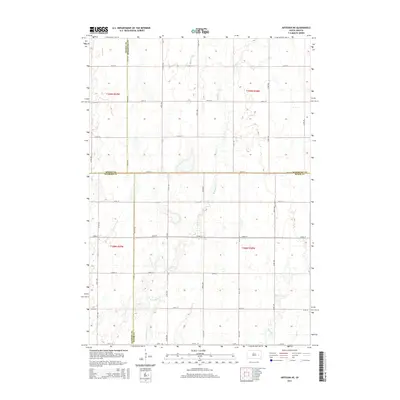
2015 Map of Artesian NE
USGS Topo · Published 2015About this map
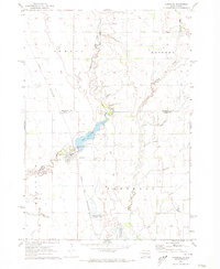
W Redstone Cr meanders across this rural section of the South Dakota prairie, where four counties converge. The landscape is defined by the Public Land Survey System, creating a precise grid of sections and section-line roads like 420th Ave and 220th St. This area represents the open agricultural character of the Glacial Lake Agassiz region, where subtle elevation changes guide the flow of Redstone Cr and Jim Cr. The convergence of Beadle Co, Kingsbury Co, Sanborn Co, and Miner Co boundaries highlights the map's significance for local administrative history and land ownership research. The lack of concentrated settlements underscores the vast, open-range nature of the terrain during the early twenty-first century, preserving the original homestead layout established during the era of prairie settlement.
Find a feature on this map
25 named features on this map. Tap any name to fly to it.
Don’t see what you’re looking for? This feature index may not catch every label — zoom into the map to look around manually.
Map Details
Editions of this 2015 Artesian NE Map
This is the sole edition of this map. No revisions or reprints were ever made.
Other maps of this area

1899 · De Smet
USGS Topo · 1:125,000

1953 · Watertown
USGS Topo · 1:250,000

1958 · Watertown
USGS Topo · 1:250,000

1971 · Iroquois
USGS Topo · 1:24,000
1971 · Artesian NW
USGS Topo · 1:24,000
1971 · Pearl Creek Colony
USGS Topo · 1:24,000

1971 · Fedora
USGS Topo · 1:24,000
1971 · Artesian
USGS Topo · 1:24,000

1971 · Artesian NE
USGS Topo · 1:24,000
1971 · Carthage
USGS Topo · 1:24,000