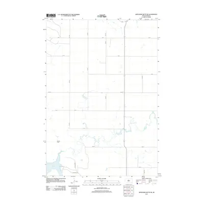
2012 Map of Artichoke Butte NE
USGS Topo · Published 2012About this map
Lake Oahe dominates the southwestern corner of this landscape in Potter County, where the Missouri River reservoir meets the rugged shoreline of South Dakota. The topography is defined by the winding course of Artichoke Cr, which snakes through the central and eastern sections, and the seasonal drainage of Spring Draw to the west. This 2012 survey illustrates a sparsely populated agricultural region structured by a precise grid of rural roads, including Sutton Bay Rd and Sutton Bay Trl. The map reflects the modern management of this riverside environment, balancing the vast water resources of the reservoir with the established section-line road network that facilitates access to the surrounding prairie and hills.
Find a feature on this map
18 named features on this map. Tap any name to fly to it.
Don’t see what you’re looking for? This feature index may not catch every label — zoom into the map to look around manually.
Map Details
Editions of this 2012 Artichoke Butte NE Map
This is the sole edition of this map. No revisions or reprints were ever made.
Other maps of this area

1953 · McIntosh
USGS Topo · 1:250,000

1954 · Pierre
USGS Topo · 1:250,000

1958 · Pierre
USGS Topo · 1:250,000

1958 · McIntosh
USGS Topo · 1:250,000

1965 · Artichoke Butte
USGS Topo · 1:24,000

1965 · Agar SW
USGS Topo · 1:24,000

1965 · Artichoke Butte SW
USGS Topo · 1:24,000

1969 · Artichoke Butte NW
USGS Topo · 1:24,000

1969 · Patch Skin Buttes SW
USGS Topo · 1:24,000

1969 · Patch Skin Buttes SE
USGS Topo · 1:24,000