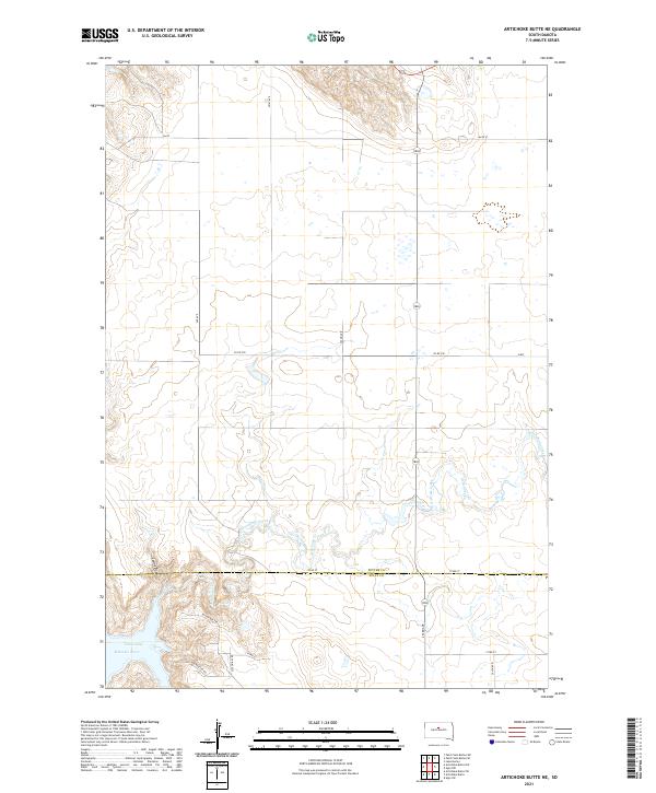
2021 Map of Artichoke Butte NE
USGS Topo · Published 2021About this map
The Missouri River and the expansive Lake Oahe reservoir dominate the southwestern corner of this landscape, where the Sutton Bay RD and Sutton Bay TRL provide access to the water's edge. This 2021 survey reveals a vast prairie topography transitioning into the deeply carved drainage of Artichoke Creek, which meanders across the southern sections of the quadrangle. The boundary between Potter County and Sully County bisects the southern reaches, marking a transition in local jurisdiction amidst a network of section-line roads like 172nd St and 293rd Ave. While much of the terrain is defined by its agricultural grid, the natural contours of Spring Draw and the winding course of the Artichoke Creek tributaries illustrate the complex hydrology feeding into the Missouri basin.
Find a feature on this map
25 named features on this map. Tap any name to fly to it.
Don’t see what you’re looking for? This feature index may not catch every label — zoom into the map to look around manually.
Map Details
Editions of this 2021 Artichoke Butte NE Map
This is the sole edition of this map. No revisions or reprints were ever made.
Other maps of this area

1953 · McIntosh
USGS Topo · 1:250,000

1954 · Pierre
USGS Topo · 1:250,000

1958 · Pierre
USGS Topo · 1:250,000

1958 · McIntosh
USGS Topo · 1:250,000

1965 · Artichoke Butte
USGS Topo · 1:24,000

1965 · Agar SW
USGS Topo · 1:24,000

1965 · Artichoke Butte SW
USGS Topo · 1:24,000

1969 · Artichoke Butte NW
USGS Topo · 1:24,000

1969 · Patch Skin Buttes SW
USGS Topo · 1:24,000

1969 · Patch Skin Buttes SE
USGS Topo · 1:24,000