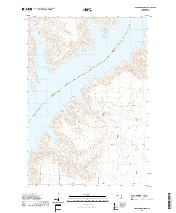
2021 Map of Artichoke Butte SW
USGS Topo · Published 2021About this map
The Missouri River flows through this landscape, marking the boundary between Sully and Dewey counties. The river valley is dominated by Lake Oahe, a massive reservoir that reshaped the region's hydrology. High on the bluffs overlooking the water, Blair Cem provides a point of genealogical interest, situated near the modern grid of local roads including 179th St and 286th Ave. The terrain transitions from the water's edge to inland features like Fuller Lake and the drainage of Bloody Run. These small water bodies and seasonal draws like Bull Creek characterize the prairie landscape as it meets the engineered waters of the Missouri. The map also records rural infrastructure like Fairbank Pl, which serves as a rare landmark in this sparsely populated stretch of the Great Plains.
Find a feature on this map
28 named features on this map. Tap any name to fly to it.
Don’t see what you’re looking for? This feature index may not catch every label — zoom into the map to look around manually.
Map Details
Editions of this 2021 Artichoke Butte SW Map
This is the sole edition of this map. No revisions or reprints were ever made.
Other maps of this area

1954 · Pierre
USGS Topo · 1:250,000

1958 · Pierre
USGS Topo · 1:250,000

1965 · Artichoke Butte
USGS Topo · 1:24,000

1965 · Okobojo NE
USGS Topo · 1:24,000

1965 · Artichoke Butte SW
USGS Topo · 1:24,000

1965 · Okobojo
USGS Topo · 1:24,000

1969 · No Heart Creek SE
USGS Topo · 1:24,000

1969 · Artichoke Butte NW
USGS Topo · 1:24,000
1970 · Artichoke Butte NE
USGS Topo · 1:24,000
1973 · Mail Shack Creek
USGS Topo · 1:24,000