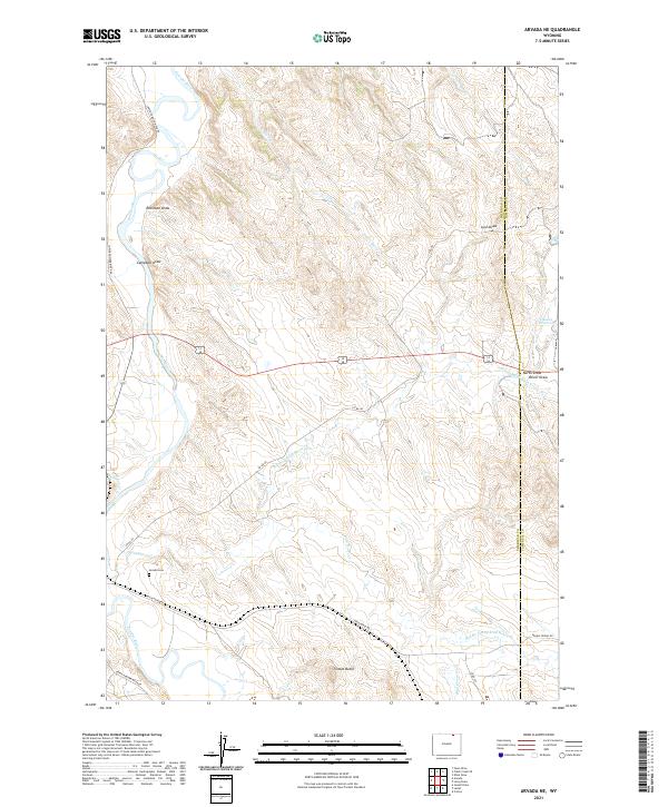
2021 Map of Arvada NE
USGS Topo · Published 2021About this map
The Powder River meanders through this section of the Wyoming basin, shaping a landscape defined by an intricate network of seasonal drainages and named draws. Near the western edge, the Arvada Cem serves as a quiet landmark of local history just north of Wild Horse Cr. The topography is characterized by significant natural elevations like Tincom Butte, which overlooks the complex confluence of the N Prong Wild Horse Cr and the Middle Prong Wild Horse Cr. To the northeast, the Okeson Reservoir and drainage features such as Lynn Draw and Joe Cr suggest a landscape managed for water retention and livestock grazing. The map also delineates the Sheridan Co Campbell Co boundary, illustrating the geopolitical division of these expansive ranchlands where routes like Wild Horse Rd and Co Rd 40 provide the primary connections across the undulating terrain.
Find a feature on this map
25 named features on this map. Tap any name to fly to it.
Don’t see what you’re looking for? This feature index may not catch every label — zoom into the map to look around manually.
Map Details
Editions of this 2021 Arvada NE Map
This is the sole edition of this map. No revisions or reprints were ever made.
Other maps of this area

1954 · Gillette
USGS Topo · 1:250,000

1955 · Sheridan
USGS Topo · 1:250,000

1955 · Gillette
USGS Topo · 1:250,000

1958 · Gillette
USGS Topo · 1:250,000

1958 · Sheridan
USGS Topo · 1:250,000

1962 · Gillette
USGS Topo · 1:250,000

1962 · Sheridan
USGS Topo · 1:250,000

1971 · Larey Draw
USGS Topo · 1:24,000

1971 · Cabin Creek SE
USGS Topo · 1:24,000
1971 · Kline Draw
USGS Topo · 1:24,000