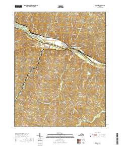
2019 Map of Arvonia
USGS Topo · Published 2019About this map
The James River serves as the central artery for this section of the Piedmont, separating Fluvanna and Buckingham counties. The community of Bremo Bluff stands prominently on the northern bank, connected to New Canton by the John H Cocke Memorial Bridge. This area is defined by a series of long-standing family settlements and rural crossings, with the historic slate-producing region near Arvonia and LeSueur south of the river. The map identifies numerous family burial grounds, including Bettie Cem, Proffitt Cem, and Oak Hill Cem, which offer significant value for genealogical research.
Find a feature on this map
89 named features on this map. Tap any name to fly to it.
Don’t see what you’re looking for? This feature index may not catch every label — zoom into the map to look around manually.
Map Details
Editions of this 2019 Arvonia Map
This is the sole edition of this map. No revisions or reprints were ever made.
Other maps of this area

1891 · Palmyra
USGS Topo · 1:125,000

1895 · Palmyra
USGS Topo · 1:125,000

1897 · Palmyra
USGS Topo · 1:125,000

1943 · Scottsville
USGS Topo · 1:62,500

1946 · Scottsville
USGS Topo · 1:62,500

1947 · Roanoke
USGS Topo · 1:250,000

1950 · Dillwyn
USGS Topo · 1:62,500

1958 · Dillwyn
USGS Topo · 1:62,500

1959 · Roanoke
USGS Topo · 1:250,000

1960 · Columbia
USGS Topo · 1:62,500