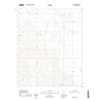
2018 Map of Ash Creek Ranch
USGS Topo · Published 2018About this map
Ash Creek Ranch anchors the high desert landscape of Graham County, where the transition between drainage basins is marked by an extensive system of water management features. Ranching operations are centered around the namesake Ash Cr and its N Fork Ash Cr, supported by a network of catchments including South Headquarters Tank and Green Mountain Tank. This survey reflects a traditional southwestern grazing landscape where land use is dictated by the availability of water at isolated points like Bone Spring.
Find a feature on this map
29 named features on this map. Tap any name to fly to it.
Don’t see what you’re looking for? This feature index may not catch every label — zoom into the map to look around manually.
Map Details
Editions of this 2018 Ash Creek Ranch Map
This is the sole edition of this map. No revisions or reprints were ever made.
Other maps of this area

1954 · Clifton
USGS Topo · 1:250,000

1954 · Mesa
USGS Topo · 1:250,000

1957 · Mesa
USGS Topo · 1:250,000

1957 · Clifton
USGS Topo · 1:250,000

1958 · Clifton
USGS Topo · 1:250,000

1958 · Mesa
USGS Topo · 1:250,000

1960 · Mesa
USGS Topo · 1:250,000

1960 · Bylas
USGS Topo · 1:62,500

1960 · Fort Thomas
USGS Topo · 1:62,500

1962 · Clifton
USGS Topo · 1:250,000