
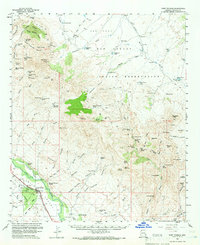
1960 Map of Fort Thomas
USGS Topo · Published 1961About this map
Fort Thomas sits as a primary settlement along the Southern Pacific railroad line in this 1960 survey of Graham County. The geography is defined by the broad Gila Valley and the vast expanse of the San Carlos Indian Reservation, which covers much of the northern and central terrain. This era of the landscape is marked by an extensive network of water management features necessary for ranching and industry, including Ninemile Tank, Paymaster Tank, and several wells such as Shortys Well.
Find a feature on this map
106 named features on this map. Tap any name to fly to it.
Don’t see what you’re looking for? This feature index may not catch every label — zoom into the map to look around manually.
Map Details
Editions of this 1960 Fort Thomas Map
2 editions found
Other maps of this area

1944 · Jackson Mtn.
USGS Topo · 1:62,500

1946 · Jackson Mtn.
USGS Topo · 1:62,500

1954 · Silver City
USGS Topo · 1:250,000

1954 · Clifton
USGS Topo · 1:250,000

1954 · Mesa
USGS Topo · 1:250,000

1956 · Tucson
USGS Topo · 1:250,000

1957 · Mesa
USGS Topo · 1:250,000

1957 · Clifton
USGS Topo · 1:250,000

1958 · Silver City
USGS Topo · 1:250,000

1958 · Clifton
USGS Topo · 1:250,000