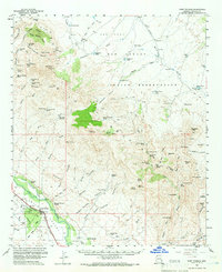
1960 Map of Fort Thomas
USGS Topo · Published 1966About this map
Fort Thomas serves as the focal point of this desert landscape, situated along the Southern Pacific railroad and the Gila Valley in the 1960s. The settlement's history is anchored by several burial grounds, including the Fort Thomas Cem and the McEuen Cem, while the Colvin-Jones road and a nearby Landing Strip provide a glimpse into mid-century transportation patterns. The surrounding terrain is defined by dramatic elevation changes, from the level Ash Flat to the north to the prominent Gila Peak and Slaughter Mtn.
Find a feature on this map
112 named features on this map. Tap any name to fly to it.
Don’t see what you’re looking for? This feature index may not catch every label — zoom into the map to look around manually.
Map Details
Editions of this 1960 Fort Thomas Map
2 editions found

Other maps of this area

1944 · Jackson Mtn.
USGS Topo · 1:62,500

1946 · Jackson Mtn.
USGS Topo · 1:62,500

1954 · Silver City
USGS Topo · 1:250,000

1954 · Clifton
USGS Topo · 1:250,000

1954 · Mesa
USGS Topo · 1:250,000

1956 · Tucson
USGS Topo · 1:250,000

1957 · Mesa
USGS Topo · 1:250,000

1957 · Clifton
USGS Topo · 1:250,000

1958 · Silver City
USGS Topo · 1:250,000

1958 · Clifton
USGS Topo · 1:250,000