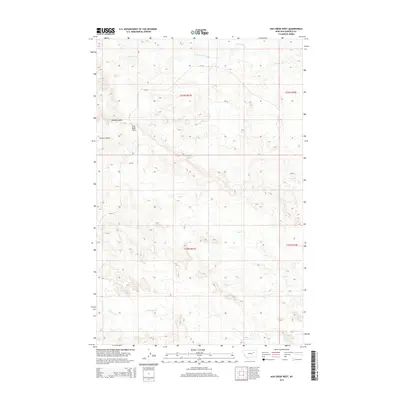
2014 Map of Ash Creek West
USGS Topo · Published 2014About this map
Coal Bank Hill rises as a prominent landmark in this segment of Garfield County, marking a landscape defined by the intricate drainage networks of the Missouri River plateau. The area is dissected by numerous seasonal waterways, including the winding paths of S Fork Box Cr in the north and Lone Tree Cr to the south. This terrain, characterized by erosion-carved features like Penick Coulee, reflects the geological processes typical of the Montana plains where high ridges separate wide, dry creek beds.
Find a feature on this map
12 named features on this map. Tap any name to fly to it.
Don’t see what you’re looking for? This feature index may not catch every label — zoom into the map to look around manually.
Map Details
Editions of this 2014 Ash Creek West Map
This is the sole edition of this map. No revisions or reprints were ever made.
Other maps of this area

1954 · Jordan
USGS Topo · 1:250,000

1956 · Jordan
USGS Topo · 1:250,000

1958 · Jordan
USGS Topo · 1:250,000

1958 · Sage Creek Point
USGS Topo · 1:24,000

1964 · Jordan
USGS Topo · 1:250,000

1972 · Short Creek
USGS Topo · 1:24,000
1972 · Gilbert Creek SE
USGS Topo · 1:24,000

1972 · Flat Creek School
USGS Topo · 1:24,000
1972 · Spring Creek Bay
USGS Topo · 1:24,000
1972 · Gilbert Creek
USGS Topo · 1:24,000