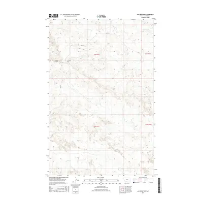
2017 Map of Ash Creek West
USGS Topo · Published 2017About this map
Coal Bank Hill and Penick Coulee define the undulating relief of this Garfield County landscape, where the drainage patterns of several small creeks dictate the layout of the land. In this 2017 study, the high plateau of the Big Dry country is carved by Ash Cr and Lost Cr, reflecting the intermittent water cycles common to the northern plains. The primary artery for navigation through these ranchlands is Haxby Rd, which winds through township boundaries including t23n r41e and t22n r41e. The topographical detail captures the subtle coulees and ridges that have shaped land use in this part of Montana for generations, providing an essential record for those tracing family ranching interests or land ownership across the open range.
Find a feature on this map
13 named features on this map. Tap any name to fly to it.
Don’t see what you’re looking for? This feature index may not catch every label — zoom into the map to look around manually.
Map Details
Editions of this 2017 Ash Creek West Map
This is the sole edition of this map. No revisions or reprints were ever made.
Other maps of this area

1954 · Jordan
USGS Topo · 1:250,000

1956 · Jordan
USGS Topo · 1:250,000

1958 · Jordan
USGS Topo · 1:250,000

1958 · Sage Creek Point
USGS Topo · 1:24,000

1964 · Jordan
USGS Topo · 1:250,000

1972 · Short Creek
USGS Topo · 1:24,000
1972 · Gilbert Creek SE
USGS Topo · 1:24,000

1972 · Flat Creek School
USGS Topo · 1:24,000
1972 · Spring Creek Bay
USGS Topo · 1:24,000
1972 · Gilbert Creek
USGS Topo · 1:24,000