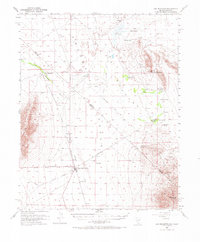
1952 Map of Ash Meadows
USGS Topo · Published 1971About this map
The Amargosa Desert straddles the arid border of Nevada and California, dominated by a landscape of scattered springs and specialized desert industries. At the heart of this region is Death Valley Junction, a hub defined by the remnants of the Tonopah and Tidewater Railroad, which once served the local mining and transport needs of the Amargosa Valley. The importance of groundwater in this environment is evident through named watering points like Crystal Pool, Fairbanks Spr, and Franklin Well, which supported both livestock and early settlements.
Find a feature on this map
39 named features on this map. Tap any name to fly to it.
Don’t see what you’re looking for? This feature index may not catch every label — zoom into the map to look around manually.
Map Details
Editions of this 1952 Ash Meadows Map
4 editions found
Other maps of this area

1908 · Furnace Creek
USGS Topo · 1:250,000

1910 · Furnace Creek
USGS Topo · 1:250,000

1940 · Eagle Tank
USGS Topo · 1:62,500

1942 · Skull Mountain
USGS Topo · 1:125,000

1942 · Bullfrog
USGS Topo · 1:125,000

1948 · Death Valley
USGS Topo · 1:250,000

1951 · Funeral Peak
USGS Topo · 1:62,500

1951 · Eagle Mtn
USGS Topo · 1:62,500

1952 · Ash Meadows
USGS Topo · 1:62,500

1952 · Ryan
USGS Topo · 1:62,500