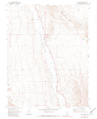
1969 Map of Ash Springs
USGS Topo · Published 1982About this map
Ash Springs serves as the focal point of this arid Lincoln County landscape, situated where the high desert floor meets the Pahranagat Valley. The 1969 field survey details a region defined by its water sources and livestock infrastructure, featuring Brownie Spring and a Corral positioned near unidentified Ruins. These markers of human activity contrast with the stark geological formations of the Hiko Range, which rises to the east and includes prominent landmarks like Table Top Mtn.
Find a feature on this map
15 named features on this map. Tap any name to fly to it.
Don’t see what you’re looking for? This feature index may not catch every label — zoom into the map to look around manually.
Map Details
Editions of this 1969 Ash Springs Map
2 editions found
Other maps of this area

1945 · Alamo
USGS Topo · 1:125,000

1954 · Caliente
USGS Topo · 1:250,000

1959 · Caliente
USGS Topo · 1:250,000

1969 · Alamo SE
USGS Topo · 1:24,000

1969 · Alamo NE
USGS Topo · 1:24,000

1969 · Alamo
USGS Topo · 1:24,000

1969 · Ash Springs
USGS Topo · 1:24,000

1970 · Hiko SE
USGS Topo · 1:24,000

1970 · Hiko
USGS Topo · 1:24,000
1980 · Alamo
USGS Topo · 1:24,000