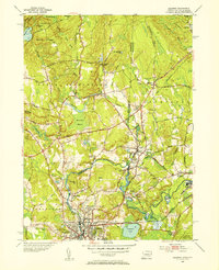
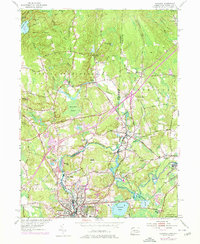
1953 Map of Ashaway
USGS Topo · Published 1955About this map
The Pawcatuck River serves as the winding centerpiece of this 1953 survey, defining the border between Connecticut and Rhode Island as it flows through heavy woodland and industrial river towns. The dual settlement of Westerly and Pawcatuck marks a significant population center at the southern edge, where the New York New Haven and Hartford railroad cuts through the urban landscape. To the north, the geography shifts toward rural hamlets and textile mill sites like Potter Hill and Ashaway, which are situated along the Ashaway River. The terrain is characterized by a series of prominent rises including Mount Moriah and Champlin Hill, interspersed with water bodies like Wyassup Lake and Chapman Pond. Significant conservation lands are already established, including portions of the Pachaug State Forest and the Woody Hill Reservation, framing the legacy of early colonial turnpikes and family-named landmarks like Pendleton Hill.
Find a feature on this map
60 named features on this map. Tap any name to fly to it.
Don’t see what you’re looking for? This feature index may not catch every label — zoom into the map to look around manually.
Map Details
Editions of this 1953 Ashaway Map
5 editions found
Other maps of this area

1889 · Stonington
USGS Topo · 1:62,500

1889 · Charlestown
USGS Topo · 1:62,500

1889 · Moosup
USGS Topo · 1:62,500

1890 · Kent
USGS Topo · 1:62,500

1893 · Moosup
USGS Topo · 1:62,500

1893 · Stonington
USGS Topo · 1:62,500

1894 · Kent
USGS Topo · 1:62,500

1919 · Charlestown
USGS Topo · 1:62,500

1920 · Moosup
USGS Topo · 1:62,500

1921 · Charlestown
USGS Topo · 1:62,500