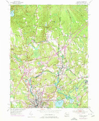
1953 Map of Ashaway
USGS Topo · Published 1976About this map
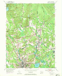
The Pawcatuck River carves a winding path through this borderland, serving as the literal boundary between North Stonington, Connecticut, and Hopkinton, Rhode Island. The mid-century landscape is defined by the industrial and residential clusters of Westerly and Pawcatuck, where the river’s power once drove local economies. Notable settlements such as Potter Hill, White Rock, and Stillmanville line the riverbanks, reflecting a tight-knit network of riverside communities.
Find a feature on this map
74 named features on this map. Tap any name to fly to it.
Don’t see what you’re looking for? This feature index may not catch every label — zoom into the map to look around manually.
Map Details
Editions of this 1953 Ashaway Map
5 editions found
Other maps of this area

1889 · Stonington
USGS Topo · 1:62,500

1889 · Charlestown
USGS Topo · 1:62,500

1889 · Moosup
USGS Topo · 1:62,500

1890 · Kent
USGS Topo · 1:62,500

1893 · Moosup
USGS Topo · 1:62,500

1893 · Stonington
USGS Topo · 1:62,500

1894 · Kent
USGS Topo · 1:62,500

1919 · Charlestown
USGS Topo · 1:62,500

1920 · Moosup
USGS Topo · 1:62,500

1921 · Charlestown
USGS Topo · 1:62,500