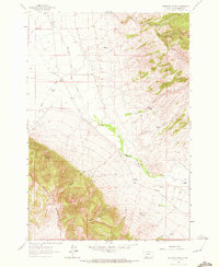
1961 Map of Ashbough Canyon
USGS Topo · Published 1972About this map
Blacktail Mountains dominate the southwestern portion of this landscape, rising sharply from the basin formed by Blacktail Deer Creek. The area is characterized by a series of deep canyons and gulches, including Ashbough Canyon, Coyote Canyon, and Van Camp Canyon, which carve through the high ground towards the drainage floor. This 1961 field check shows a predominantly ranch-based economy with family-named operations like Landon Ranch, Conover Ranch, and Rock Island Ranch situated near vital water sources. The presence of Borrow Pits and a Mine suggests small-scale resource extraction alongside the grazing activity. A peculiar landmark, Irishmans Hole, marks the rugged slopes below the main ridgeline, indicating the specialized local nomenclature of the Beaverhead County backcountry.
Find a feature on this map
21 named features on this map. Tap any name to fly to it.
Don’t see what you’re looking for? This feature index may not catch every label — zoom into the map to look around manually.
Map Details
Editions of this 1961 Ashbough Canyon Map
2 editions found
Other maps of this area

1893 · Dillon
USGS Topo · 1:250,000

1952 · Gallagher Mountain
USGS Topo · 1:24,000

1955 · Dubois
USGS Topo · 1:250,000

1955 · Dillon
USGS Topo · 1:250,000

1957 · Dillon
USGS Topo · 1:250,000

1958 · Dubois
USGS Topo · 1:250,000

1958 · Dillon
USGS Topo · 1:250,000

1961 · Christensen Ranch
USGS Topo · 1:24,000

1961 · Ashbough Canyon
USGS Topo · 1:24,000

1961 · Elk Gulch
USGS Topo · 1:24,000