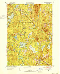
1950 Map of Ashburnham
USGS Topo · Published 1952About this map
Lower Naukeag Lake and Upper Naukeag Lake anchor a landscape defined by significant water resources and early industrial settlements along the border of Massachusetts and New Hampshire. The Boston and Maine Railroad cuts through the region, serving historic stops like the Old North Ashburnham Sta, which once linked these upland communities to larger manufacturing hubs. Smaller clusters such as Converseville, Lane Village, and Blackburn Village suggest a late-19th-century pattern of development centered around local mills and the North Branch Millers River.
Find a feature on this map
71 named features on this map. Tap any name to fly to it.
Don’t see what you’re looking for? This feature index may not catch every label — zoom into the map to look around manually.
Map Details
Editions of this 1950 Ashburnham Map
4 editions found
Other maps of this area

1887 · Winchendon
USGS Topo · 1:62,500

1887 · Fitchburg
USGS Topo · 1:62,500

1889 · Fitchburg
USGS Topo · 1:62,500

1890 · Winchendon
USGS Topo · 1:62,500

1893 · Fitchburg
USGS Topo · 1:62,500

1894 · Winchendon
USGS Topo · 1:62,500

1898 · Monadnock
USGS Topo · 1:62,500

1900 · Peterboro
USGS Topo · 1:62,500

1931 · Fitchburg
USGS Topo · 1:48,000

1932 · Winchendon
USGS Topo · 1:48,000