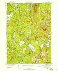
1950 Map of Ashburnham
USGS Topo · Published 1958About this map
Ashburnham and its surrounding hamlets are depicted here during a period of mid-century stability, where the rugged topography of the New Hampshire border dictates the layout of its roads and settlements. The town center sits at the confluence of the Boston and Maine RR and Main St, while smaller industrial or residential clusters like Lane Village and Blackburn Village are linked by winding paths through the many hills. The landscape is dominated by water and wood, with Lower Naukeag Lake and Upper Naukeag Lake serving as central landmarks alongside extensive State Forest lands. Genealogical researchers will find localized detail in labels such as School No 8 and Wilder Cem, while the industrial history of the region is noted by the presence of the Old North Ashburnham Sta. Peaks such as Mount Watatic and Little Watatic Mountain provide a dramatic backdrop to the dispersed mountain ponds and brooks that feed the Miller River.
Find a feature on this map
68 named features on this map. Tap any name to fly to it.
Don’t see what you’re looking for? This feature index may not catch every label — zoom into the map to look around manually.
Map Details
Editions of this 1950 Ashburnham Map
4 editions found
Other maps of this area

1887 · Winchendon
USGS Topo · 1:62,500

1887 · Fitchburg
USGS Topo · 1:62,500

1889 · Fitchburg
USGS Topo · 1:62,500

1890 · Winchendon
USGS Topo · 1:62,500

1893 · Fitchburg
USGS Topo · 1:62,500

1894 · Winchendon
USGS Topo · 1:62,500

1898 · Monadnock
USGS Topo · 1:62,500

1900 · Peterboro
USGS Topo · 1:62,500

1931 · Fitchburg
USGS Topo · 1:48,000

1932 · Winchendon
USGS Topo · 1:48,000