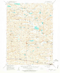
1948 Map of Ashby
USGS Topo · Published 1963About this map
Ashby and Hyannis anchor the southern corridor of this Nebraska Sandhills landscape, situated along the tracks of the Chicago Burlington and Quincy railroad. The map reveals an extensive network of family-owned ranching operations, including the Adamss Ranch, Becker Ranch, and Keller Ranch, which utilize the natural meadows and valleys of the region. This 1948 survey documents the vital water resources that sustain the cattle industry here, ranging from the prominent Mother Lake and Alkali Lake to numerous flowing wells and smaller basins like Dipping Vat Lake. The social organization of these rural townships is marked by the presence of the Ferguson-Becker Sch, Keller Sch, and a Consolidated Sch, showing how education was localized among the ranches. Landforms such as Hospital Valley and Indian Hill provide the topographic definition for this unique grazing country.
Find a feature on this map
49 named features on this map. Tap any name to fly to it.
Don’t see what you’re looking for? This feature index may not catch every label — zoom into the map to look around manually.
Map Details
Editions of this 1948 Ashby Map
7 editions found
Other maps of this area

1948 · Ashby
USGS Topo · 1:62,500

1948 · Bingham
USGS Topo · 1:62,500

1948 · Spade Ranch
USGS Topo · 1:62,500

1948 · George Lake
USGS Topo · 1:62,500

1948 · Whitman
USGS Topo · 1:62,500

1948 · Spring Valley
USGS Topo · 1:62,500

1949 · Ashby
USGS Topo · 1:62,500

1949 · Steverson Lake
USGS Topo · 1:62,500

1949 · Turpin Lake
USGS Topo · 1:62,500

1950 · Spring Valley
USGS Topo · 1:62,500