
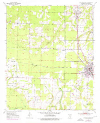
1950 Map of Ashdown West
USGS Topo · Published 1956About this map
Ashdown serves as a central hub in this mid-century survey, positioned where the Kansas City Southern and St Louis San Francisco railroads intersect. This rail network defined the local economy, connecting the agricultural lands of Little River County to broader markets. The landscape is carved by a complex system of waterways, including Lick Creek, Hemphill Creek, and Muddy Creek, which feed into the low-lying Tyler Slough and Beaver Pond areas.
Find a feature on this map
27 named features on this map. Tap any name to fly to it.
Don’t see what you’re looking for? This feature index may not catch every label — zoom into the map to look around manually.
Map Details
Editions of this 1950 Ashdown West Map
2 editions found
Other maps of this area

1950 · Redbank
USGS Topo · 1:24,000

1950 · Ashdown East
USGS Topo · 1:24,000

1950 · Ogden
USGS Topo · 1:24,000

1950 · Ben Lomond
USGS Topo · 1:24,000

1950 · Barkman
USGS Topo · 1:24,000

1950 · Falls Chapel
USGS Topo · 1:24,000

1950 · Winthrop
USGS Topo · 1:24,000

1951 · Winthrop
USGS Topo · 1:24,000

1951 · Redbank
USGS Topo · 1:24,000

1951 · Ben Lomond
USGS Topo · 1:24,000