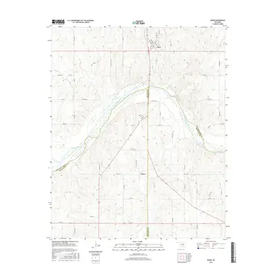
2016 Map of Asher
USGS Topo · Published 2016About this map
Asher sits at a geographic crossroads where Pottawatomie Co, Mcclain Co, and Pontotoc Co meet near a prominent northern bend of the Canadian River. This 2016 survey illustrates the modern layout of the town, including its grid of streets such as Main ST and Broadway ST. South of the river, the landscape transitions into the rural settlement area of Chism, defined by a network of county roads and local drainages like Big Cr and Chism Cr. The presence of Cook Cem near the riverbanks provides a specific point of interest for those researching local family histories. The river itself serves as a major dividing line between counties, with numerous smaller tributaries like Julian Cr and Pond Creek carving through the terrain as they flow toward the main channel.
Find a feature on this map
56 named features on this map. Tap any name to fly to it.
Don’t see what you’re looking for? This feature index may not catch every label — zoom into the map to look around manually.
Map Details
Editions of this 2016 Asher Map
This is the sole edition of this map. No revisions or reprints were ever made.
Other maps of this area

1896 · Seminole and Prague
USGS Topo · 1:125,000

1898 · Purcell
USGS Topo · 1:125,000

1898 · Pauls Valley
USGS Topo · 1:125,000

1901 · Stonewall
USGS Topo · 1:125,000

1902 · Pauls Valley
USGS Topo · 1:125,000

1907 · Maud
USGS Topo · 1:62,500

1908 · Maud
USGS Topo · 1:62,500

1910 · McComb
USGS Topo · 1:62,500

1954 · Oklahoma City
USGS Topo · 1:250,000

1957 · Ardmore
USGS Topo · 1:250,000