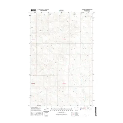
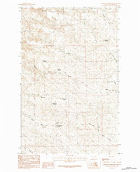
2017 Map of Ashford Coulee
USGS Topo · Published 2017About this map
The Larb Hills rise above a landscape defined by an intricate network of drainages and seasonal water sources in this section of Valley County. The terrain is dominated by various coulees, including McNab Coulee, Limekiln Coulee, and Tank Coulee, which channel water toward the larger creek systems. Water management is evident through the presence of Luther Reservoir and the reliable Ashford Spring, essential landmarks for land use in this arid region of Montana. Transport and access are limited to remote tracks such as Sunset Ln and Skyview Ridge Rd, reflecting the low density of human settlement. The map provides a detailed view of the drainage patterns of Square Cr and the forks of Antelope Creek, illustrating how local topography dictates the flow of water across these plains.
Find a feature on this map
16 named features on this map. Tap any name to fly to it.
Don’t see what you’re looking for? This feature index may not catch every label — zoom into the map to look around manually.
Map Details
Editions of this 2017 Ashford Coulee Map
This is the sole edition of this map. No revisions or reprints were ever made.
Other maps of this area

1905 · Saco Special
USGS Topo · 1:62,500

1906 · Hinsdale Special Map
USGS Topo · 1:62,500

1954 · Glasgow
USGS Topo · 1:250,000

1957 · Glasgow
USGS Topo · 1:250,000

1958 · Glasgow
USGS Topo · 1:250,000
1984 · Hardpan Coulee
USGS Topo · 1:24,000

1984 · Ashford Coulee
USGS Topo · 1:24,000
1984 · Saco
USGS Topo · 1:24,000
1984 · Flat Coulee
USGS Topo · 1:24,000
1984 · Christmas Reservoir
USGS Topo · 1:24,000