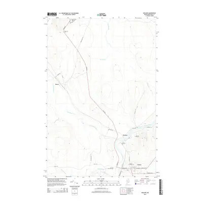
2014 Map of Ashland
USGS Topo · Published 2014About this map
The Aroostook River and Machias River converge at the heart of this Maine landscape, defining the layout of the settlement at Ashland. By 2014, the area maintained a distinct connection to its northern forestry and transit roots, with Portage Rd serving as a central spine through the territory. Several family and community burial grounds, such as Old Saint Marks Cem and Dunn Cem, are situated along the riverbanks and secondary roads like Sheridan Rd, offering specific locations for genealogical research. The map also traces the smaller hamlet of Sheridan and the community of Skerry to the northwest, where the Little Machias River winds through the hills. This survey records the proximity of the Allen St Peter Memorial Airport to the northern settlements, highlighting the region's reliance on both local airfields and traditional river-valley corridors.
Find a feature on this map
37 named features on this map. Tap any name to fly to it.
Don’t see what you’re looking for? This feature index may not catch every label — zoom into the map to look around manually.
Map Details
Editions of this 2014 Ashland Map
This is the sole edition of this map. No revisions or reprints were ever made.
Other maps of this area

1928 · Winterville
USGS Topo · 1:48,000

1929 · Portage
USGS Topo · 1:62,500

1930 · Greenlaw
USGS Topo · 1:48,000

1931 · Ashland
USGS Topo · 1:48,000

1931 · Portage
USGS Topo · 1:62,500

1931 · Winterville
USGS Topo · 1:62,500

1933 · Greenlaw
USGS Topo · 1:62,500

1934 · Ashland
USGS Topo · 1:62,500

1953 · Ashland
USGS Topo · 1:62,500

1953 · Portage
USGS Topo · 1:62,500