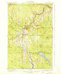
1934 Map of Ashland
USGS Topo · Published 1934About this map
The Aroostook River winds through the heart of this North Woods landscape, serving as the primary corridor for settlement and industry in the early 1930s. The town of Ashland and the nearby village of Sheridan anchor the central valley, where the Bangor and Aroostook railroad tracks trace the riverbanks to facilitate the timber trade. This era of local education is remarkably well-documented, with numerous rural schoolhouses scattered across the townships, including the Old Stetson Sch, Garfield Sch, and McClellan Sch.
Find a feature on this map
57 named features on this map. Tap any name to fly to it.
Don’t see what you’re looking for? This feature index may not catch every label — zoom into the map to look around manually.
Map Details
Editions of this 1934 Ashland Map
3 editions found
Other maps of this area

1928 · Winterville
USGS Topo · 1:48,000

1929 · Portage
USGS Topo · 1:62,500

1929 · Caribou
USGS Topo · 1:48,000

1930 · Greenlaw
USGS Topo · 1:48,000

1931 · Ashland
USGS Topo · 1:48,000

1931 · Portage
USGS Topo · 1:62,500

1931 · Winterville
USGS Topo · 1:62,500

1932 · Caribou
USGS Topo · 1:62,500

1933 · Greenlaw
USGS Topo · 1:62,500

1934 · Ashland
USGS Topo · 1:62,500