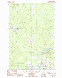
1986 Map of Ashland
USGS Topo · Published 1986About this map
The Aroostook River and Machias River converge in this northern Maine timber and agricultural landscape during the mid-1980s. The settlement of Ashland serves as a regional hub, connected to outlying communities like Sheridan and Skerry. Industrial and utility infrastructure is evident through several Gravel Pits, a Trans Line, and the Radio Tower (WAGM) standing near the riverbanks.
Find a feature on this map
28 named features on this map. Tap any name to fly to it.
Don’t see what you’re looking for? This feature index may not catch every label — zoom into the map to look around manually.
Map Details
Editions of this 1986 Ashland Map
This is the sole edition of this map. No revisions or reprints were ever made.
Other maps of this area

1928 · Winterville
USGS Topo · 1:48,000

1929 · Portage
USGS Topo · 1:62,500

1930 · Greenlaw
USGS Topo · 1:48,000

1931 · Ashland
USGS Topo · 1:48,000

1931 · Portage
USGS Topo · 1:62,500

1931 · Winterville
USGS Topo · 1:62,500

1933 · Greenlaw
USGS Topo · 1:62,500

1934 · Ashland
USGS Topo · 1:62,500

1953 · Ashland
USGS Topo · 1:62,500

1953 · Portage
USGS Topo · 1:62,500