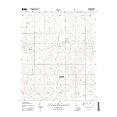
2015 Map of Ashland
USGS Topo · Published 2015About this map
Ashland serves as the focal point of this Benton County survey, characterized by its central street grid including Main St N and Court St. The town sits at a crossroads of rural routes like Ripley Ave and Shiloah Rd, surrounded by a landscape defined by significant water features and family-named landmarks. To the west, the resort-oriented community of Snow Lake Shores borders the waters of Snow Lake, while the southern portion of the map is dominated by the protected woodlands of the Holly Springs National Forest. The area is notably dense with local burial grounds, including Bethlehem Cem, Jordan Cem, and Ayers Cem, which provide essential touchstones for genealogical research. Throughout the territory, numerous watercourses such as Big Snow Cr, Yellow Rabbit Cr, and the Tippah River drain the lowlands like Robinson Bottom.
Find a feature on this map
80 named features on this map. Tap any name to fly to it.
Don’t see what you’re looking for? This feature index may not catch every label — zoom into the map to look around manually.
Map Details
Editions of this 2015 Ashland Map
This is the sole edition of this map. No revisions or reprints were ever made.
Other maps of this area

1944 · Potts Camp
USGS Topo · 1:62,500

1945 · Potts Camp
USGS Topo · 1:62,500

1950 · Ashland
USGS Topo · 1:62,500

1953 · Holly Springs
USGS Topo · 1:62,500

1955 · Blue Mountain
USGS Topo · 1:62,500

1956 · Tupelo
USGS Topo · 1:250,000

1958 · Tupelo
USGS Topo · 1:250,000

1964 · Holly Springs SE
USGS Topo · 1:24,000
1965 · Lamar
USGS Topo · 1:24,000
1969 · Holly Springs
USGS Topo · 1:62,500