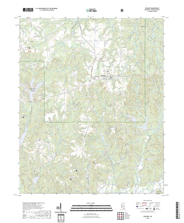
2024 Map of Ashland
USGS Topo · Published 2024About this map
Ashland serves as the focal point of this Benton County survey, centered around the Benton County Courthouse and the local Ashland Cent school. The town's grid is defined by streets such as Main St, Walnut St, and Ripley Ave, while the surrounding landscape is heavily influenced by the presence of the Holly Springs National Forest. To the west, the residential community of Snow Lake Shores borders the waters of Snow Creek, contrasting with the more dispersed rural layout of the forest lands.
Find a feature on this map
85 named features on this map. Tap any name to fly to it.
Don’t see what you’re looking for? This feature index may not catch every label — zoom into the map to look around manually.
Map Details
Editions of this 2024 Ashland Map
This is the sole edition of this map. No revisions or reprints were ever made.
Other maps of this area

1944 · Potts Camp
USGS Topo · 1:62,500

1945 · Potts Camp
USGS Topo · 1:62,500

1950 · Ashland
USGS Topo · 1:62,500

1953 · Holly Springs
USGS Topo · 1:62,500

1955 · Blue Mountain
USGS Topo · 1:62,500

1956 · Tupelo
USGS Topo · 1:250,000

1958 · Tupelo
USGS Topo · 1:250,000

1964 · Holly Springs SE
USGS Topo · 1:24,000
1965 · Lamar
USGS Topo · 1:24,000
1969 · Holly Springs
USGS Topo · 1:62,500