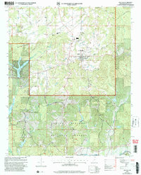
2000 Map of Ashland
USGS Topo · Published 2003About this map
The county seat of Ashland serves as the central hub of this northern Mississippi landscape, where the town’s development transitions into the protected woodlands of the Holly Springs National Forest. The map documents a community rich in rural institutions, from the Old Salem Sch and Gray Academy to numerous congregational centers like Macedonia Ch and South Ashland Ch. These labels provide a clear spatial record for genealogists tracing family roots in Benton County at the start of the millennium.
Find a feature on this map
61 named features on this map. Tap any name to fly to it.
Don’t see what you’re looking for? This feature index may not catch every label — zoom into the map to look around manually.
Map Details
Editions of this 2000 Ashland Map
This is the sole edition of this map. No revisions or reprints were ever made.
Other maps of this area

1944 · Potts Camp
USGS Topo · 1:62,500

1945 · Potts Camp
USGS Topo · 1:62,500

1950 · Ashland
USGS Topo · 1:62,500

1953 · Holly Springs
USGS Topo · 1:62,500

1955 · Blue Mountain
USGS Topo · 1:62,500

1956 · Tupelo
USGS Topo · 1:250,000

1958 · Tupelo
USGS Topo · 1:250,000

1964 · Holly Springs SE
USGS Topo · 1:24,000
1965 · Lamar
USGS Topo · 1:24,000
1969 · Holly Springs
USGS Topo · 1:62,500