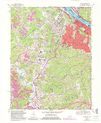
1968 Map of Ashland
USGS Topo · Published 1985About this map
Industrial and institutional growth along the Ohio River characterizes this late-1960s perspective of the region. The city of Ashland serves as a dense hub of infrastructure, with its grid of schools like Crabbe Sch and Putnam Jr High Sch organized around Central Park. Beyond the urban core, the landscape transitions into a complex network of hollows and ridges, where developments like the Federal Youth Center and Ashland Vocational Sch sit near Summit.
Find a feature on this map
72 named features on this map. Tap any name to fly to it.
Don’t see what you’re looking for? This feature index may not catch every label — zoom into the map to look around manually.
Map Details
Editions of this 1968 Ashland Map
3 editions found
Other maps of this area

1898 · Ironton
USGS Topo · 1:62,500

1900 · Ironton
USGS Topo · 1:62,500

1901 · Ceredo
USGS Topo · 1:62,500

1903 · Kenova
USGS Topo · 1:125,000

1904 · Kenova
USGS Topo · 1:125,000

1913 · Ceredo
USGS Topo · 1:62,500

1926 · Greenup
USGS Topo · 1:48,000

1930 · Greenup
USGS Topo · 1:62,500

1953 · Rush
USGS Topo · 1:24,000

1953 · Boltsfork
USGS Topo · 1:24,000